Explore climates.im

Discoveries

Unusual official findings, and a name that had to wait until 2017.

Asperitas looks, in the Atlas, like a roughened sea from below. Cavum joined the same list. Two official Met Office pages still do not use the same high-cloud height.

Some of the oddest official facts about clouds are not the everyday cumulus in the window. They are two height tables, a 2017 name for a roughened-sea undersurface, and photographs that refuse to say more than their titles.
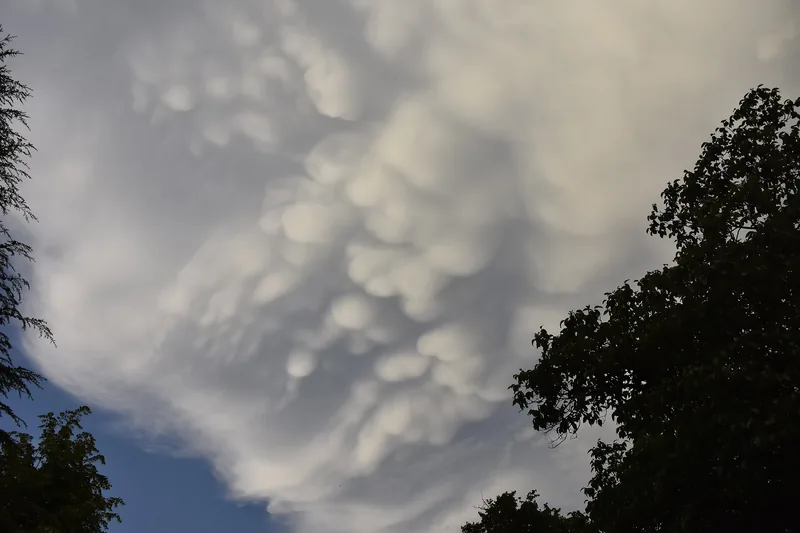
A chaotic, wave-like undersurface of cloud, photographed in 2021, from a file titled only in Turkish as asperitas clouds.
A photograph dated 19 June 2021, by Kesim00, released under CC0. The file title is “Undulatus asperatus asperitas bulutları” — asperitas clouds, in the file’s own words. This desk does not claim that the World Meteorological Organization classified this particular frame. The official 2017 Atlas definition of asperitas lives in the articles, beside the picture, not as a secret label on it. Photo: Kesim00 · CC0 · Kesim00 / Wikimedia Commons

A supplementary feature that looks like a sea from below

The 2017 Atlas preface is a list of new names: volutus, asperitas, cauda, cavum, fluctus, murus, flumen. [source] The asperitas definition is the rare official paragraph that sounds like literature and is still a standard: “as if viewing a roughened sea surface from below.” [source] The photograph on this page is not that official example. It is a CC0 still titled, in the file’s own words, as asperitas clouds.
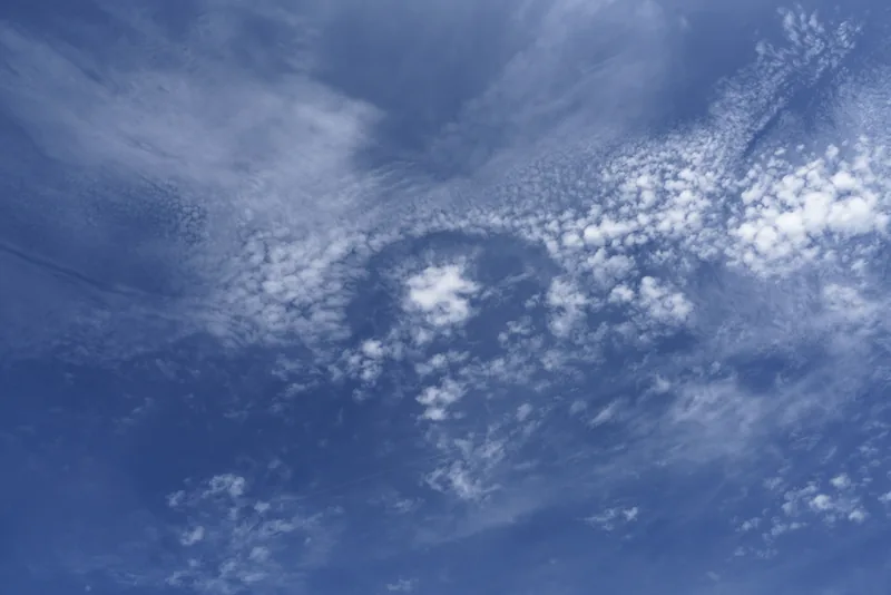
A sharp hole in a layer of altocumulus, with streaks falling from the opening, photographed over Dortmund.
A fallstreak hole or punch hole cloud (the file’s words: special cloud form “cavum”) embedded in an altocumulus layer, seen in Dortmund on 12 August 2018, photographed by Franz van Duns. Used under CC BY-SA 4.0, on this website only. The WMO’s 2017 Atlas preface lists cavum among five new supplementary features; this desk does not invent an Atlas definition beyond that list and the file caption. Photo: Franz van Duns · CC BY-SA 4.0 · Franz van Duns / Wikimedia Commons

A hole with a new official name

Fallstreak holes, or punch holes, are the sort of shape people already had nicknames for. The 2017 preface puts cavum on the official list of supplementary features. [source] Franz van Duns’s Dortmund photograph, 12 August 2018, uses both the nickname and the new name in one caption.
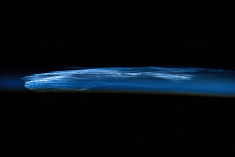
A band of silvery high-altitude noctilucent clouds seen from the International Space Station above a darkened Earth.
Noctilucent clouds photographed from the International Space Station on 18 July 2024 (iss071e406995), as it orbited 258 miles above eastern Turkey. The official NASA Johnson caption: “Noctilucent clouds, high altitude clouds only visible when the Sun is below the Earth's horizon and illuminating them.” Photo: NASA Johnson · Public domain · NASA Johnson / Wikimedia Commons

Clouds that wait until after sunset

NASA Johnson’s 18 July 2024 caption is almost a riddle: high-altitude clouds only visible when the Sun is below the Earth's horizon and illuminating them, seen 258 miles above eastern Turkey. They are not slipped into the ten genera on this desk.
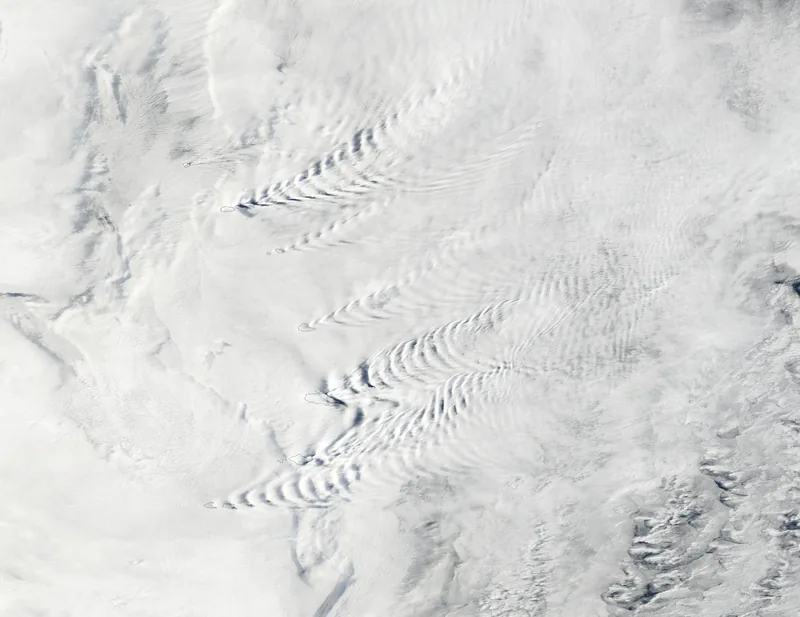
A true-colour satellite view of wave-like cloud patterns rippling around the South Sandwich Islands.
Wave clouds around the South Sandwich Islands, in a true-colour image captured on 17 March 2025 by the MODIS instrument on NASA’s Aqua satellite, and published 19 March 2025. The official caption describes a remote arc of volcanic peaks about 1,000 miles (1,600 kilometres) northeast of the Antarctic Peninsula, in a windy region sometimes called the Furious Fifties, and says the combination of winds and topography helps produce wave clouds, volcano tracks and lenticular clouds. Satellite image: MODIS Land Rapid Response Team, NASA GSFC · Public domain · NASA GSFC / MODIS / Wikimedia Commons

Waves in the Furious Fifties

The official Aqua MODIS caption for 17 March 2025 does not just say “wave clouds.” It puts them around a remote volcanic arc, about 1,000 miles northeast of the Antarctic Peninsula, in a windy belt it names the Furious Fifties, and it groups wave clouds with volcano tracks and lenticulars as things those islands help to produce.

20,000 feet, and 18,000 feet

Two official Met Office pages, two high-cloud thresholds. [source] [source] The discovery is that they were both opened, and neither was quietly corrected.
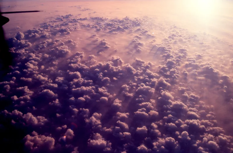
A field of white cumulus heaps in a blue sky, from a NOAA file that does not name a place.
A NOAA file titled Cumulus clouds14 - NOAA, dated 12 November 2005 on the file page. The file does not name a photographer and does not give a scene caption. This desk credits NOAA and does not invent a location or a story for the frame. Photo: NOAA (photographer not named on the file) · Public domain · NOAA / Wikimedia Commons

A file that will not invent a place

Cumulus clouds14 - NOAA, 12 November 2005: no photographer, no scene caption. That honesty is itself worth keeping.

Keep the lights on

Enjoyed a desk of official cloud genera, two height tables, and a few unusual shapes?

No pop-ups. No intrusive advertising. Just interesting stuff. A little support helps the next climates.im site get built.