Explore climates.im

Shapes that had to wait for a name

Unusual clouds

Asperitas and cavum were added to the Atlas in 2017. Lenticulars and mammatus have a dated Met Office explanation. Noctilucent clouds shine after the Sun has gone.
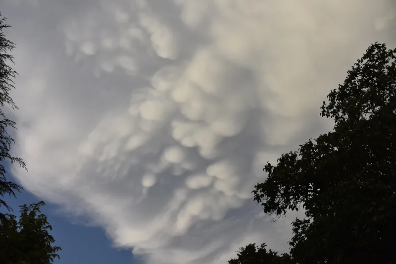
A chaotic, wave-like undersurface of cloud, photographed in 2021, from a file titled only in Turkish as asperitas clouds.
A photograph dated 19 June 2021, by Kesim00, released under CC0. The file title is “Undulatus asperatus asperitas bulutları” — asperitas clouds, in the file’s own words. This desk does not claim that the World Meteorological Organization classified this particular frame. The official 2017 Atlas definition of asperitas lives in the articles, beside the picture, not as a secret label on it. Photo: Kesim00 · CC0 · Kesim00 / Wikimedia Commons

The preface to the 2017 International Cloud Atlas added one new species (volutus), five new supplementary features (asperitas, cauda, cavum, fluctus and murus), and one new accessory cloud (flumen). [source]

Asperitas, in the Atlas definition, is: “Well-defined, wave-like structures in the underside of the cloud; more chaotic and with less horizontal organization than the variety undulatus. Asperitas is characterized by localized waves in the cloud base, either smooth or dappled with smaller features, sometimes descending into sharp points, as if viewing a roughened sea surface from below. Varying levels of illumination and thickness of the cloud can lead to dramatic visual effects.” It “Occurs mostly with Stratocumulus and Altocumulus.” [source] The photograph above is labelled only with its file title, “Undulatus asperatus asperitas bulutları.” This desk does not claim the Atlas classified that frame.
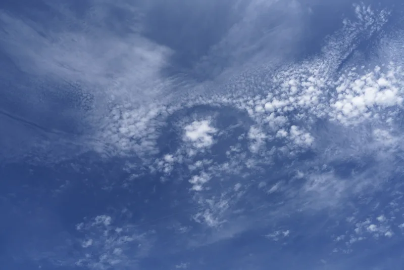
A sharp hole in a layer of altocumulus, with streaks falling from the opening, photographed over Dortmund.
A fallstreak hole or punch hole cloud (the file’s words: special cloud form “cavum”) embedded in an altocumulus layer, seen in Dortmund on 12 August 2018, photographed by Franz van Duns. Used under CC BY-SA 4.0, on this website only. The WMO’s 2017 Atlas preface lists cavum among five new supplementary features; this desk does not invent an Atlas definition beyond that list and the file caption. Photo: Franz van Duns · CC BY-SA 4.0 · Franz van Duns / Wikimedia Commons

Cavum is on the same 2017 list of new supplementary features. [source] The Dortmund photograph is captioned, on the file, as a fallstreak hole or punch hole cloud, the special form “cavum,” embedded in altocumulus, on 12 August 2018. That is the file’s wording, used here beside the Atlas list, not as a substitute for a full Atlas paragraph this desk has not opened.
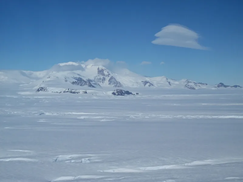
Smooth, lens-shaped clouds stacked over a dark Antarctic mountain.
Lenticular clouds over Mount Murphy, Antarctica, seen on an Operation IceBridge survey on 7 November 2014, in a NASA photograph by Jim Yungel, published 18 November 2014. The official caption: “The disk-shaped clouds seen here result from high winds being disrupted by the nearby mountain.” Photo: Jim Yungel, NASA Operation IceBridge · Public domain · NASA ICE / Jim Yungel / Wikimedia Commons
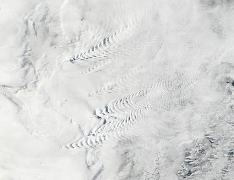
A true-colour satellite view of wave-like cloud patterns rippling around the South Sandwich Islands.
Wave clouds around the South Sandwich Islands, in a true-colour image captured on 17 March 2025 by the MODIS instrument on NASA’s Aqua satellite, and published 19 March 2025. The official caption describes a remote arc of volcanic peaks about 1,000 miles (1,600 kilometres) northeast of the Antarctic Peninsula, in a windy region sometimes called the Furious Fifties, and says the combination of winds and topography helps produce wave clouds, volcano tracks and lenticular clouds. Satellite image: MODIS Land Rapid Response Team, NASA GSFC · Public domain · NASA GSFC / MODIS / Wikimedia Commons

A Met Office blog dated 15 September 2026 says lenticular clouds are commonly associated with altocumulus, and that Altocumulus lenticularis clouds “are smooth, lens-shaped clouds that can sometimes resemble flying saucers,” particularly associated with hilly or mountainous terrain in stable air. Although strong winds may be flowing through them, “the clouds can remain in much the same position because condensation is continually occurring at the wave’s crest and evaporation at its downstream edge.” [source] NASA’s IceBridge caption for the Mount Murphy still is shorter: disk-shaped clouds from high winds disrupted by the nearby mountain, seen on 7 November 2014. The Aqua MODIS view of 17 March 2025 shows wave clouds etched around the South Sandwich Islands, in a region the official caption calls the Furious Fifties.
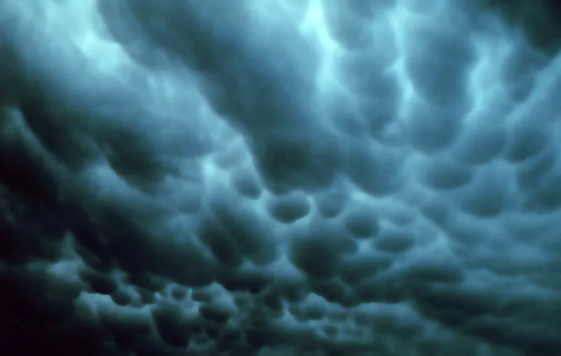
A historic 1973 photograph of pouch-like mammatus clouds hanging under a dark sky in Tulsa, Oklahoma.
Mammatus clouds in Tulsa, Oklahoma, USA, 2 June 1973, from the NOAA Photo Library and the National Severe Storms Laboratory, in the wording of the file description. Photo: NOAA · Public domain · NOAA / Wikimedia Commons
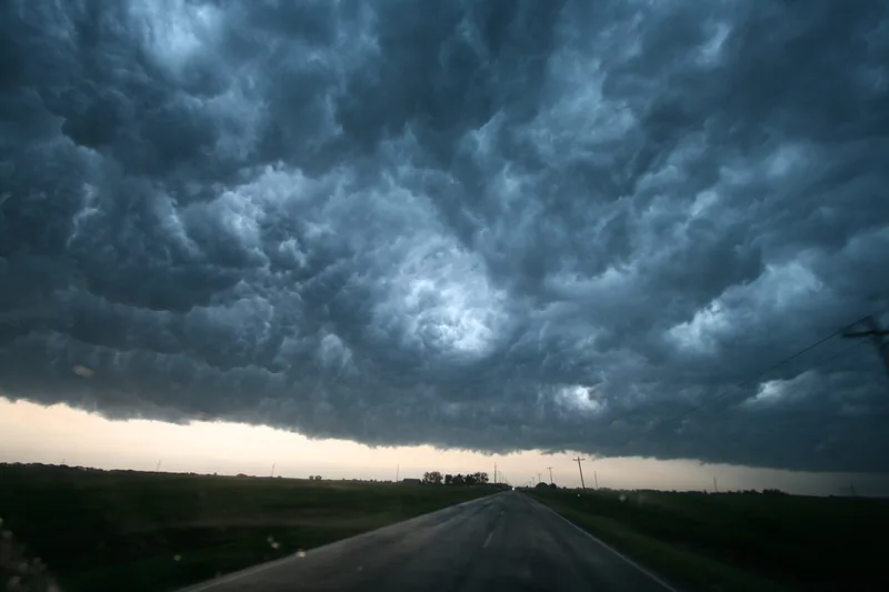
Dark, pouch-like cloud bases hanging under a thunderstorm sky near Enid, Oklahoma.
Thunderstorm and supercell clouds observed during VORTEX2, near Enid, Oklahoma, photographed on 15 May 2009 by Sean Waugh of NOAA’s National Severe Storms Laboratory. The file page credits VORTEX2. The hanging pouches in the frame are the kind of form a 2026 Met Office blog discusses as mammatus; the file caption itself names a spectacular thunderstorm and supercell, not the word mammatus. Photo: Sean Waugh, NOAA/NSSL · Public domain · NOAA/NSSL / Sean Waugh / Wikimedia Commons

The same 2026 Met Office blog says mammatus describes “distinctive pouch-like formations that usually appear beneath a cumulonimbus cloud,” and that mammatus clouds form in very different atmospheric conditions from mountain-wave lenticulars: an unstable atmosphere, most commonly associated with thunderstorms. [source] The Tulsa still is explicitly captioned as mammatus, 2 June 1973. The Enid, Oklahoma, still from VORTEX2 on 15 May 2009 is captioned as spectacular thunderstorm and supercell clouds; the pouches are in the picture, and the file itself does not use the word mammatus.
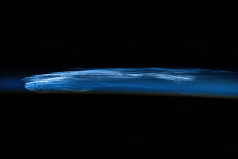
A band of silvery high-altitude noctilucent clouds seen from the International Space Station above a darkened Earth.
Noctilucent clouds photographed from the International Space Station on 18 July 2024 (iss071e406995), as it orbited 258 miles above eastern Turkey. The official NASA Johnson caption: “Noctilucent clouds, high altitude clouds only visible when the Sun is below the Earth's horizon and illuminating them.” Photo: NASA Johnson · Public domain · NASA Johnson / Wikimedia Commons

And some clouds sit so high they wait for the Sun to go below the horizon before they can be seen. NASA Johnson’s caption from the International Space Station, 18 July 2024, is the official sentence this desk uses for noctilucent clouds: high-altitude clouds only visible when the Sun is below the Earth's horizon and illuminating them, photographed 258 miles above eastern Turkey.

Keep the lights on

Enjoyed a desk of official cloud genera, two height tables, and a few unusual shapes?

No pop-ups. No intrusive advertising. Just interesting stuff. A little support helps the next climates.im site get built.