Luke Howard’s 1802 names are still the start of the official system. A 22° halo is a way to see ice in high cloud without opening a textbook first.
A NOAA file titled Cumulus clouds14 - NOAA, dated 12 November 2005 on the file page. The file does not name a photographer and does not give a scene caption. This desk credits NOAA and does not invent a location or a story for the frame.Photo: NOAA (photographer not named on the file) · Public domain · NOAA / Wikimedia Commons
The heaps you can see on a fair day have an old official name. The Met Office says Luke Howard, in 1802, split clouds into three main types — stratus, the layers; cumulus, the heaps; and cirrus, the wisps — and that we largely use the same system today, later extended to ten genera. [source]
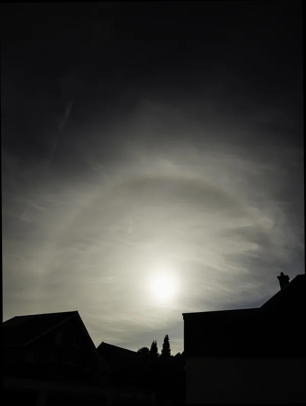
A cirrostratus layer with a 22° halo centred on the sun, photographed on 1 March 2024 by Franz van Duns. The file description says this halo form is formed by ice crystals in the upper troposphere. Used under CC BY 4.0. The Met Office schools page, separately, notes that cirrostratus is a transparent sheet, often with a halo.Photo: Franz van Duns · CC BY 4.0 · Franz van Duns / Wikimedia Commons
Sometimes a high, thin sheet shows a ring around the sun. The schools page calls cirrostratus a transparent sheet, often with a halo. [source] The photograph is a 22° halo in just such a sheet.
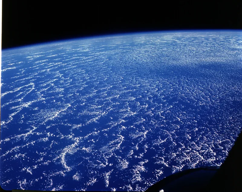
A large network of stratocumulus clouds southwest of the Canary Islands, photographed from Gemini 6A on 16 December 1965 (S65-63264). The official caption says these are open cellular-type convective clouds in which air rises along the cell walls and sinks in the centres, with a foreground surface wind from the northeast at 25 to 35 km/h (15 to 20 knots), and that the blue band along the horizon is the Earth’s troposphere.Spacecraft image: NASA, Gemini 6A · Public domain · NASA / Gemini 6A / Wikimedia Commons
And some official pictures are simply beautiful: an open network of stratocumulus southwest of the Canary Islands, photographed from Gemini 6A in 1965, with a blue band of atmosphere along the horizon. The quiz on this site uses official wording, and will not ask anyone to average 20,000 feet with 18,000.